Showing posts with label Spring. Show all posts

Wednesday, May 25, 2011

The Typhoon Rule signals the coming of cooler weather

I am realizing this week that it is better to be hot and uncomfortable than to be under the repeat threats of tornadoes and severe thunderstorms. Please be in prayer for those suffering in the Midwest and others who are threatened even as I write this article.

Out in the Far East , Typhoon Songda, is providing some hope of a break in the summer heat.  If she follows her predicted path then sometime late Friday or Saturday she will turn east in advance of a trough closing in on Japan.  That would signal the coming of a trough and cooler air to the eastern US either next weekend or early the following week.

Typhoon Songda is forecast to recurve late Friday or Saturday
Image Source: Univ of Wisconsin SSEC

It would not surprise me at all to see out first tropical storm or hurricane of the Atlantic Season in the 6-10 day time frame.  The strong departing heat ridge if it were a summer pattern would have a risk of a tropical system on its SW quadrant. 

Regardless, a break in the worst sustained heat of the entire summer 2011 is coming.

Nightmare storm continues the menace the midwest

The unbelievable storm which has spawned an EF-5 Tornado that destroyed Joplin, MO on Sunday killing 123 people continues to rage in its 3rd day.  So far this year 501 people have lost their lives this year placing the number of deaths at #7 and the year is only half over!  The NOAA estimates that 1,000 tornadoes have occurred so far.  Read more about this horrific season.

A cold pool of air in the upper levels and a huge temperature contrast with the heat that is dominating the east is fueling the storm system which looks like an inland hurricane at times.

East of the menacing swirl are 2 sources of heat that will
dominate through next week. 
Image Source: Univ of Wisconsin SSEC
As of this evening it appears that the storm will weaken Friday as it crosses the Appalachians and leaves its cold upper level support.  Conceptually, I would have a hard time with the idea that the storm could maintain it's strength and organization for that long.  That being said... we need to watch its progression eastward. 

Tomorrow will be a long day west of the mountains as more tornadoes and severe storms threaten lives and property.  Be in prayer for the people who are recovering from the tragic losses and those who are being threatened.

Monday, May 9, 2011

Cool to Moderate temperatures will contine for next 10-14 days

The weather amazes me because of how it can defy millions of dollars in computing power and an army of professionals and enthusiasts.  There are many tools that can be used to attempt to get an angle of what God's tremendous weather machine is trying to accomplish.

As spring progresses toward it's inevitable conclusion I find the Global Synoptic Dynamic Model (GSDM) to be very useful.  It attempts to integrate atmospheric angular momentum (AAM), MJO activity, and the AAM trend to produce yet another tool called the Global Wind Oscillation (GWO).   Weather is full of acronyms!

I find the GSDM useful as a means to explain where the weather pattern has been an IN GENERAL where it is headed.  It is not useful in forecasting local or regional events but can be used to support or debunk other long range models. Here is the past 40 days of the Global Wind Oscillation:
Notice how the Historic tornado outbreak marked a recent bottom in
global AAM.  The reluctant tight spiral up featured further severe weather
and a repetitive weather pattern that is leading to massive midwest flooding.
Source: NOAA Earth Science Research Laboratory, Physical Sciences Division
     Where might the general weather pattern be headed here in NC and VA? The GWO is probably already in Phase 5.  Based on trends in the tropics I believe that phases 5, 6, and 8 will best describe the next 10-14 days.  See below how temperatures correlate to these phases.
Therefore we can expect moderate to cool temperatures on average.  I am expecting the Phase 6 trough to bring storms on Thursday and a cool weekend.

Tuesday, April 26, 2011

Take tropical notice of what happened today

The little tropical  swirl that has been evident since the weekend took some very significant action today.  While the center of the low level closed circulation plodded westward through the southern Bahamas heat, humidity and convection spread thunderstorms and heavy downpours inland through the Carolinas and parts of VA.

Did you notice the summertime temperature, steamy humidity, low billowing clouds, and downpours which some occurred with virtually no radar warning.  Could this be a foreshadowing of tropical storms this summer?   Had the center of the storm been stronger and therefore "stacked" higher then it would have most likely followed the same flow which was aimed right at us.

The small swirling low pressure has separated
from the tropical plume. 
Image Source: Univ of Wisc SSEC
There is a risk of severe thunderstorm activity tomorrow and more likely Thursday as an approaching cold front collides with the existing heat and humidity.  This is nothing like the once in a lifetime caliber outbreak over a week ago but caution should be exercised nonetheless. 

Saturday, April 23, 2011

The Travails of an April Tropical Low

April development of a tropical storm system is very rare.  The one attempting to get started in the SW Atlantic has an artistic looking low swirl that has the banded features that one would look for in a storm.  So, even if the winds are great and the water temps are marginal why is the storm failing yet to thrive?

First, let's look at the storm:

Well defined swirl in the SW Atlantic.
Source: Univ of Wisconsin SSEC

The failure to thrive seems to be caused by dry air in the atmosphere which is starving the storm of being able to produce the convective (like thunderstorms) activity needed to deepen the system and expand it's influence.
Driest air exists where the low level swirl is located.
Source: Univ of Wisconsin SSEC

As time passes so does the window of opportunity for the system to strengthen before the return of fast westerlies sweeps it away.

Thursday, April 21, 2011

Storm Formation in the SW Atlantic

No April Fools!  There is a storm system taking shape in the Southwest Atlantic which could acquire some tropical characteristics during the next few days.  WeatherBell Analytics Meteorologist Joe Bastardi has been anticipating this feature for quite some time.  While the storm is interesting it is not expected to play a role in our weather.
National Hurricane Center gives the forming system only a 10% probability
of reaching Subtropical or Tropical storm strength during the next 2 days.
It is important to take notice of the fact that the storm system is forming before the official start of the Atlantic Hurricane Season.  Next week a strong Bermuda High and marginal water temperatures will provide some key ingredients to warm the storm center and give it an opportunity to get a name.

Models seem to agree that the system will weaken and turn SW over the next 3-5 days.  None of them seem to be impressed with the storm's prospects for early notoriety.

Sunday, April 17, 2011

A Sort of ... Green light to plant your summer garden

While I do have some concerns about snowcover in Canada and the Arctic providing a high availability of cold air late this month into May it is time to go ahead and plant your summer garden.  This is not a 100% confident "Green Light", maybe greenish-yellow.  Here are my reasons:
  1. The weather pattern here in NC and Central VA is stormy.  No intrusions of cold air capable of frost is expected during the next 2 weeks.
  2. Despite the availability of cold air there is no guarantee that the eastern US would be the target.  
  3. Seedlings can only be maintained in cups for so long. Some of my plants are consuming their water supply daily.  So, either accept a low risk of an unusual late April/early May front or the plants outgrow their containers.
As always.  I planted some tomatoes and peppers today.  Therefore my plants share the same risk as everyone else.

Coming this week:  Summer and Tropics 2011 preview.

Saturday, April 16, 2011

URGENT: Tornado Watch as Severe Thunderstorms are now INBOUND

Ladies and gentlemen;

      I have never seen the National Weather Service add the phrase "This is a particularly dangerous situation" to a Tornado Watch.  The storms are now crossing the Triad and should reach Chapel Hill near 1:20-1:30 then cross the whole Triangle during the following 45 minutes.

     What has me really worried is the potential for tornadoes that are stronger and cut paths of destruction.  While twisters are not very common in our region they usually are the weak variety that bounce from location to location striking with 75-90 mph winds.  TODAY storms which do not contain tornadoes will often have winds near 70 mph!

     Please be sure to be in a safe shelter away from windows during the storm passage.  Do not bet your life on being caught driving on the road or out in the open.

    Here is a link to the Raleigh Radar: http://radar.weather.gov/radar.php?rid=rax&product=N0R&overlay=11101111&loop=no

Monday, April 11, 2011

Concerned about damaging severe weather Friday-Saturday

It has been interesting trying to figure out what form the amplification signal provided by the March 31 and April 1 surge in the SOI.  Finally there is some model agreement on a scenario that I think fits the current climate's tendency for wild weather events.

An intense storm system is expected to deepen over the central Plains and move NE dragging both upper level cold and a strong frontal system through our region. It is bad enough that a cold front is going to ram into unseasonably warm air.  Upper level cold enhances probabilities of hail, damaging wind, and tornadoes.

Here are 2 projections of what could happen in the Friday evening - Saturday time frame:

  • GFS - Depicts a deepening system headed to the Great Lakes with a negatively tilted, trailing front which would bring the biggest risk of severe weather to VA and points north.


  • ECMWF - Storm follows a track just south of the Great Lakes to the NE US.  This scenario has more cold air behind it.
We will need to keep an eye on the situation this weekend.  Another update will occur as we get closer to the event.

Monday, April 4, 2011

Super high SOI signalling dramatic weather ahead?

The Southern Oscillation Index is based on the difference in surface pressure between Darwin, AU and Tahiti related to the tendency up or down.  Negative numbers and/or falling tendency signals a progressive (west to east) weather pattern.  In this case the index soared to 74, the highest I have seen, signaling an amplified (north-south) and often a blocked pattern.  The chart below shows that this occurred on April 1st. 
SOI soars to 74 on April 1st
Data Source: The Long Paddock
Computer models are showing no specific events today here in Central NC and VA on April 14-15.  This is not a surprise as models have been simply terrible through this La Nina episode.  I think that the GFS shows an interesting intense storm in the Plains that would be a headline maker if its true.
April 14 GFS - Very cold airmass dominates the east.
Count the number of sub 1000mb storms on the map!

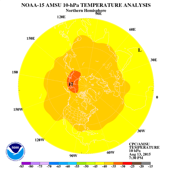
One clue that the cold air mass affecting the east beginning at the middle of this month has a lot of merit is the strong warming event in the Stratosphere advancing from Siberia to the Pole.  Such an event acts like a plunger pushing arctic air into the middle latitudes.  Unfortunately cold air surging into the the typical gyrations of spring further south is a recipe for severe storms, frosts, and freezes.
Sudden Stratospheric Warming (SSW) advances toward the Pole.
Source: NOAA Climatic Prediction Center

So, interesting days lie ahead.  You can definitely that I will be paying close attention to weather developments and will keep you informed.

Sunday, March 27, 2011

Rare Late March SNOW for Raleigh, NC?

A great distraction caused by the VCU win over Kansas and the UNC loss to KY almost caused me to miss something important going on in the weather!

Instability associated with a wave of low pressure is taking a track that could bring a rare late March snow to Central NC.   Cold air is in place and all that is needed is convection strong enough to precipitate enough to form snow.  The activity over southern TN and N AL needs to organize and maintain strength and track overnight to provide a snow event that will surprise anyone not reading this column.
The circled activity has surprise snowfall potential tomorrow morning.
Source: Univ. of Wisconsin SSEC


No significant accumulation is expected.

Tuesday, March 22, 2011

Big Weather Weekend for Eastern US

Even though Meteorological Spring runs March-May the season arrived yesterday for everyone else.  Here in Central NC and VA the sun was out, temperatures warm, daffodils blooming beautifully, and the TEMPTATION to get summer garden plants in the ground.

Two weeks ago a high pressure ridge setup in east central Asia which displaced Siberian air into North America.  Fortunately a stubborn heat ridge over Florida will blunt the worst of the cold here in the Southeast but areas north of Fredricksburg, VA are about to get buried in an early spring snowstorm.

Big storm complex is nosing SE.
Source: Univ of Wisconsin SSEC

The first storm will dump snow in the Northeast tomorrow.  The training front is windy and fairly dry but should be watched for severe thunderstorm development as it approaches NC and VA.

This weekend features the MAIN Event as Cold high pressure feeds another storm system and forces it to take a southern route.  How far south will dictate whether the snow line can reach Fredricksburg, VA and even press a bit south.  NC and the southeast will face a threat of severe thunderstorms.

GFS and other models depict deepening storm pushing east,

Following the passage of the storm I am very concerned about a frost threat, even a freeze.  My recommendation is to delay planting of summer vegetables until at least April 10.  The weather pattern is shifting to a warm west and cool stormy east.  It is best to allow the cool period to resolve itself then look at mid April to set possible planting dates.

Tuesday, March 15, 2011

Timing of late month cold snap just a little later

The appearance of a ridge in East Asia earlier this month was the beginning of a process that will come to fruition by mid next week.   While there is some model debate about how much cold will be delivered and how far south we can expect a period of cooler and stormier weather than we have seen in a while.

Another big development is the return of the negative NAO which dominated during the extraordinary cold period in December and January.  High pressure near NE Canada blocks the eastward progress of weather systems and sends them on a southerly detour.  Notice how the blocking high is expected to develop at the same time that NC and VA will be heating up!  The heat streams northward as part of the High Pressure building process which results in lower pressure, colder temperatures, and potential stormy weather in the places which were most recently warm.
NAO is once again predicted to go negative
Source: NOAA Climatic Prediction Center
I have little doubt that next week will be very exciting in the eastern US.  Stay tuned for details!

Sunday, March 6, 2011

East Asia Ridge portends late March Cold

A special thanks to Joe Bastardi  for directing my attention to recent developments in East Asia.  There is a relationship which he taught me years ago called "Cahir's Ridge", high pressure east of the Caspian Sea which pushes Siberian cold over the North Pole into North America.

Admittedly I had gotten a little weather complacent because of our new involvement with the American-Belorussian Relief Organization.  We are blessed to report that $950 has been donated toward the travel and other expenses to a little girl from the Chernobyl affected region to come to our home for 6 weeks of clean food and air, sanctuary from low level contamination, and medical assistance. 

The timing of the high pressure east of the Caspian is a relationship which would deliver the cold air to the eastern US between March 18-22.  Later this week a low pressure system is expected to replace that high, indicating that the cold surge will be short-lived.

Absolutely resist any temptation to plant your summer vegetables until after mid-April at least (Central NC and VA).  There may be a need to protect freeze sensitive lettuce and other spring cool season crops during the incoming cold snap.

Saturday, February 19, 2011

Garden 2011 is underway!

In expectation of extremes of weather through the spring and a possible (we need RAIN!) slightly cooler than average summer I have made the following vegetable choices:
  • Spring
    • Bloomsdale and Galilee Spinach: Both stand up to the heat better than most varieties.  The idea of bringing in a spinach that grows in the mideast is based on my expectation of a rough spring.  Bloomsdale gets planted now, Galilee in a month.
    • Bright Lights Swiss Chard:  The leaves and colorful stems are tasty and useful in salads or sauteed like spinach.
    • Buttercrunch Lettuce: We really love this lettuce.  Crunchy and sweet.
    • Alfresco Blend Salad Greens:  Most people I know rarely eat salad.  It is EASY to grow and when harvest to plate is immediate the taste is unbelievable!  Amazing amount of food for 2-3 square feet of space.
    • Jericho Romaine Lettuce:  We have missed the taste and texture of Romaine Lettuce.  I understand that this variety's tolerance of weather conditions reaches Biblical proportions! :>)
  • Summer - Seedlings being planted this week.
    • Siletz Tomato: Early season F1 Hybrid tomato which does not require bees or other pollination to set fruit.  This variety is intended to provide a tomato harvest in June before the mid and late season maters are ready.  The plant stands up to cool spring weather very well.
    • Homestead Tomato: My main all-purpose mid-season tomato.  Last summer we averaged 6-10 tomatoes per day from late June to early August with a peak of 29 in one day!  All from 4 plants.  I have a small garden and the 4 ft height works out really well.  
    • Whatever Craig LeHoullier offers:  My limited space forces me to only be able to have a few full-size varieties.  Those of you who have been to Tomatopalooza or followed my pictures and coverage know that Craig's work to preserve the genetic diversity of varieties which span generation is immensely valuable!  Craig is also involved in a global effort to breed new Dwarf Tomato varieties.
    • Partenon Squash: This hybrid is expensive but can both stand up to cooler temperatures (May) and set fruit without pollinators.  My plan to beat the squash bugs is to get seedlings going extra-early and use the 3 strongest plants.  Those of us who do not use pesticides have a terrible time growing squash.  I plan to revert to an open-pollinated type in 2012 if spring and early summer look more moderate.
    • Indian River Winter Pumpkin - Bug resistant vines produce the most awesome pumpkins we have ever tasted!  We were eating RAW pieces last fall.  I saved seeds after determining that they were heirloom.
    • Malabar Spinach:  A completely edible vining plant.  When the Galilee Spinach gives out then this takes over. 
    • Armenian Cucumbers:  I wanted to try something different.  Cucumbers always seem to do well in my garden.  These are related to melons and have a milder taste and thin skin. 
    • Stevia:  I am going to attempt to grow some stevia.  This mint relative imparts a sweet taste to food and beverages.  Bruised leaves can make a "sugar tea" which can be used with fruit punch or lemonade.
  • Others:  Basil, Bush Beans, Nasturtiums (bugs hate this plant.  great addition to salads).  Cayenne, Serrano, and Jalapeno pepper.  GARLIC!!! (Easy to grow!). Maybe a chocolate mint plant or other herbs.
The big theme this year to is overcome a roller-coaster spring and early summer.  If we can experience some decent rainfall this spring then the opportunity exists for a nice summer ...albeit.. with a bad hurricane season.  No west QBO to limit storm growth and keep them out to sea like last year!

Sunday, October 17, 2010

Fall/Winter Gardening, Why stop when its frosts?

Why stop when it frosts?

Thanks to book loaned to me by a good friend almost 18 months ago I learned that the joy of gardening does not stop when it frosts.  In fact, one cool season vegetables are established and a typical NC winter sets in there are no bugs, very little maintenance, and plenty of tasty Italian mixed Greens, Beets Kale, Spinach, <green> Garlic, Carrots, and other root crops.  The book by Eliot Coleman is called Four Season Harvest.

One of the principles which I learned is that it is good to pay attention to what God is serving in each season.  Greens and root crops are rich in anti-oxidants and minerals which benefit people by bolstering our immune systems and speeding recovery from winter colds and flu.
Insalata Odorosa - We have already eaten a few bowls.
Swiss Chard and Beets got a slow start no thanks to September's heat.  Now that it is cooler and I added some fertilizer the plants are on the move and will keep growing as long as temperatures stay above 27 degrees.  Swiss Chard will go dormant below 27 and re-awaken in the spring.  Beets are great when cut into strips and sauteed in a cast iron skillet in butter/coconut oil mix.  Add a dash of sugar and cook until the edges are crispy!
Rainbow Swiss Chard and Detroit Red Beets
      Spinach and Buttercrunch Lettuce are also delicious and have a great tender taste once temperatures drop.  The Lettuce will need to be eaten before a hard frost.  Spinach keeps on coming all winter long....
Viroflay Spinach and Buttercrunch Lettuce
     Kale tastes best after a hard frost and will also thrive in cold.  Another friend introduced us to the idea of making Kale hips by lightly oiling the leaves and baking them at 350 on a cookie sheet.  If that does not work out then Kale still tastes good in salads or sauteed,
Dwarf Kale is behind the Insalata Odorosa
     The next 2 weeks is garlic planting time!  Plant 1 clove every 4" and fertilize with compost and a pinch of 0-45-0 super phosphate.  Garlic can be picked green during the entire winter.  The roots that survive (because you have not eaten them yet) through next june will reward you richly with unbelievable tasting mature garlic!

    Sad you missed out?  Plant your garlic now and get your lettuce, chard, spinach ...etc... planted around March 1 for the Spring cool season campaign.