The
Southern Oscillation Index is based on the difference in surface pressure between Darwin, AU and Tahiti related to the tendency up or down. Negative numbers and/or falling tendency signals a progressive (west to east) weather pattern. In this case the index soared to 74, the highest I have seen, signaling an amplified (north-south) and often a blocked pattern. The chart below shows that this occurred on April 1st.
Computer models are showing no specific events today here in Central NC and VA on April 14-15. This is not a surprise as models have been simply terrible through this La Nina episode. I think that the GFS shows an interesting intense storm in the Plains that would be a headline maker if its true.
 |
April 14 GFS - Very cold airmass dominates the east.
Count the number of sub 1000mb storms on the map! |
|
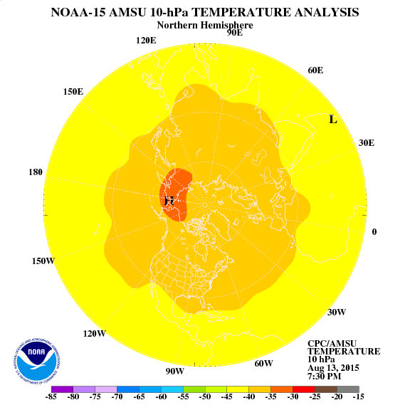
One clue that the cold air mass affecting the east beginning at the middle of this month has a lot of merit is the strong warming event in the Stratosphere advancing from Siberia to the Pole. Such an event acts like a plunger pushing arctic air into the middle latitudes. Unfortunately cold air surging into the the typical gyrations of spring further south is a recipe for severe storms, frosts, and freezes.
So, interesting days lie ahead. You can definitely that I will be paying close attention to weather developments and will keep you informed.


No comments:
Post a Comment