Wednesday, November 24, 2010

Winter 2010-11 Outlook Part 2 - What to expect

The base state of the atmosphere is expected to feature, a NW US trough which expands to the Great Lakes, and a storm track which is primarily west of the Appalachians toward the Greak Lakes.   This leaves the SE US in what is most often a mild and dry sector.  This prognostication is based on the Ocean temperature anomalies:
Ocean Sea Surface Temperature Anomalies
  1. La Nina - Cold water along the equator encourages buildup of high pressure and a subsequent slowing of Global AAM along the equator.  As a result warm high pressure is favored southeast of mountain ranges and continents.
  2. East Pacific Oscillation Zone - Positive state is favored. High Pressure NE of Hawaii favors a trough and subsequent stormy weather in the NW US.
  3. Cool Ocean near SE US - Favors stable surface high pressure.
  4. Warm near Darwin AU - Darwin downpours are great for those who want to play golf and other outdoor sports near the eastern seaboard and south of the Mason-Dixon line.  This can change quickly!
  5. The North Atlantic Oscillation Zone - The ocean favors a positive base state (mild and dry SE US) BUT there are influences which are in play to cause potential trouble. 
      Therefore we are in a situation where much of a winter will be warmer than average and dry.

Now for the interesting part...
     Winter 2010-11 will be remembered for its events not for being consistently miserable like last year.  I am deeply concerned that January's "Bear Market Rally" when the North Australia rainy season comes to an end has tremendous potential for bring destructive weather to our region.  La Nina's are well known for volatility because of the terrible cold which is often dammed up north of the jet stream.  There comes a time that imbalances must be satisfied.  The legendary snowstorm of January 2000 is an extreme version of a breakout event.  In other seasons like this one severe thunderstorms and tornadoes strike in January when they are least expected.  January 2008 featured a 4 day historic Tornadic outbreak.  The 1996 January Blizzard paralyzed the whole eastern seaboard.

     Unlike 2007-08 when I predicted very little winter at all the hurricane paths, evidence that La Nina has already hit bottom, volcanic activity, a subtropical jet stream (unusual for this weather pattern), and continued low solar all seem to indicate that this winter for Central VA and NC is one with a great deal of potential to be remembered for its misbehavior for a long time.

Tuesday, November 23, 2010

Winter 2010-11 Outlook Part 1 - The Gestalt of the Season

     Gestalt is a fascinating word which describes a structure of parts so integrated that its function cannot be figured out by examining the parts.  It also describes a very effective Psychological Therapy and is my favored method.  So what does an awesome German Philosophy have to do with the weather?  Figuring it out may drive you crazy!

    Outcomes of weather interactions are a Gestalt.  Mainstream media greatly dis-serves the public when explaining climate behavior in terms of over-used and stereotyped expressions like El Nino and La Nina.  If last year's Strong El Nino caused the dreadful cold then why did the south not freeze during the 1997-98 event, that was strong!  I guess that El Nino is easier to write than Arctic Oscillation (AO).  The AO plunged to historic negativity last winter and created a situation which Polar Regions were warmer than average because the coldest air was displaced south.  Snowlovers in VA and the mid-Atlantic feasted on endless persistent cold and delivery of moisture from the deep tropics as they were buried in snow.

    Winter 2010-11 appears poised to feature much different character than last year.  An understanding of the Science of Behavior (Psychology) is applicable to weather because as people ebb and flow in ranges of emotions, interactions, and outcomes so does nature.  Note: My undergraduate degree is a BS in Psychology.  2009-10 featured consistent winter performance and over-achievement which started and left on-time.   This season will feature a quiet student who gets hyperactive if he does not take his ADD medicine.

    Is the ocean telling us that the coming winter is destined to be a dud?  Here is the temperature pattern of Oct 2007.  The following winter we has NO SNOW:

Oct 2010 looks really similar:
      Don't give up yet!  I have been experimenting with the idea that Hurricane tracks can reveal some of what the global weather pattern is attempting to accomplish.  Notice how 2007 storms in the tropics tracked all the way west, guided by a vast subtropical high pressure.

2010 featured storms which recurved to the NE.  While there was some west Caribbean and Gulf activity the bigger storms all stayed in the Atlantic basin. 
Source Wikimedia Commons
      Our terrible summer was caused by land based torrid ridges of high pressure.  Therefore the lowest pressure and path of least resistance was out to sea.  What could this mean for winter?

      Keeping in mind that my idea is experimental .... What if the hurricane paths indicate that the lack of high pressure building during the storm season?  Could this mean that not all of winter's strong storms are going to shortcut to the Great Lakes?  Is there a chance that since high pressure flows into low that the door is open for a big Arctic event? 

    To those who are ready to give up on this winter take a look at 1999's storm paths:
Is 1999 looking a lot like 2010?

Part 2 will feature what to expect in the 2010-11 season for Central NC and VA.

Sunday, November 21, 2010

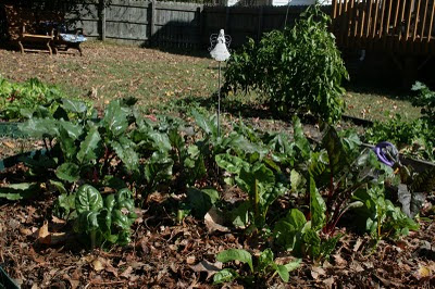
Salad Garden is still growing strong!

We are looking forward to a terrific salad with our Thanksgiving meal!  Since October there has been a freeze and several frosts yet some holdovers from Summer continue to be be productive albeit at a slow pace.

Kale tastes better after the first frosts and freezes.
It is also very nutritious.


Fall gardens require far less water and maintenance than their summer counterparts.  This deep into the cool season there is little to do but eat!  There are no bugs after the frost and only an occasional, easy to eliminate weed.

Buttercrunch lettuce is great for salads and lettuce-wraps.
Progressively cooler weather keeps the plant producing
without becoming bitter and "bolting".


     Sometimes an experimental plant can payoff.  This Montrieux Viroflay (Monster Spinach) is proving itself to be very prolific.

The dark green spinach leaves are tasty and also very nutritious.
     Other fall favorites include rainbow swiss chard and beets.  Chard is a tasty greens on celery-like stems which can be yellow, green, blue, red, or even "flamingo".  Beet greens are also useful but the root is rich in Vitamin A, Folate, Omega-6 fatty acids, and a spectrum of minerals.

Swiss Chard and Beets.
      It is still Christmas on the Cayenne Bush but more like one a week than every other day.  I recently stopped defending the bush against frost but it continues to grow OK.  There are even new blossoms!

The green fruit mean that it will once again be Christmas in a week.
      My garlic gave me a little scare.  I was concerned that it would never come up after being planted 3-4 weeks ago.  What does not end up in salads as green garlic will be harvested next June.  It is amazing how store bought garlic planted in good dirt in the last 2 weeks of October is incredible by the following summer.

Baby garlic is emerging and will grow through the winter.
     My winter forecast will be ready before the turkey is served on Thursday.  Unfortunately for lovers of winter the idea of a long boring mild stretches is definitely on the table.

Wednesday, November 17, 2010

Working on Winter Forecast

Sorry for the lack of posting the past several days.  This upcoming winter is very perplexing.  Understanding some important differences between a stereotypical La Nina and current conditions is easy.  Determining how the winter season here in NC and VA will be impacted is what is difficult.

Not quite a typical La Nina:
  • There is a split jet stream in the Pacific more typical of El Nino.
  • Rainfall in Australia definitely is not living up to La Nina.
  • Global Hurricane Production is in the dumps.  
  • The most active region, the Atlantic featured tracks that were recurvatures (north and east).
  • Ocean temperatures in the equatorial Pacific and Global Angular Momentum seem to have hit bottom in Sept/Oct instead of Dec/Jan.
Low solar activity continues and Siberian and other high latitude volcanoes have been fairly busy but not as much as 2008-09.

Therefore, anyone who forecasts a stereotypical La Nina is taking a big risk.

Thursday, November 11, 2010

Another Weekend, Another frost

Time to protect the pepper bushes once again.  Frost the next couple of nights will be the product of very dry air, common in November and not a polar or arctic blast.  Frosty mornings will give way to sunny skies and 65-70 degrees Saturday and Sunday. 

Dry air cools quickly once the sun sets and by morning 30-35 degrees colder than the previous day's highs are not that uncommon.  November is the driest month of the year in Raleigh, NC.  The length of nighttime plays a role also as we approach the darkest 2 months (Nov 21-Jan 21).

After another week of mild dry weather there is expected to be a major weather pattern change for the week of Thanksgiving.  This GFS forecast from NCEP depicts a cold high pressure system damming air down the Eastern Seaboard.  Such a pattern will certainly be colder than average and is one that would favor precipitation as warm air aloft would tend to overrun.
GFS Forecasts wedge of cold air dominating the eastern seaboard.
Source: NCEP Central Operations

Sunday, November 7, 2010

Weather Roller-Coaster! Preview of Winter?

     This morning I awoke to a ground frozen solid, frozen Kale (OK!), Greens (OK above 27), but damaged Basil, and dead tomato vines.  Bell and Cayenne Peppers were protected under a sheet and the Serrano bush appears untouched.  We gardeners dread the coming of frosts and freezes that end the summer fun.  Even the survivors of winter's first strike will go down in 7-10 days.

    Far out in the Pacfic a signal has already been sent that a jolt to the weather pattern is coming between Nov 11-13.  In a La Nina the base pattern is a trough (cool) in the West and ridge (warm) in the Southeast.  A surge of atmospheric momentum at times will shove the cold and/or storm weather east.  I measure this by adding 15 days to Southern Oscillation Index values which were measured in Australia and Tahiti.   The dip signifies a surge in momentum where it can have the greatest effect, in the deep tropics.
Dip in SOI signals coming jolt to this week's warm pattern
Data Source: The Long Paddock
     The 30 day moving average is trending downward which may be a sign of La Nina beginning her weakening process.  If I am right and this winter features a weakening La Nina then many jolts to what others may forecast as a mild, dry, boring winter are coming.

    Something to watch for in Central NC and VA is a round of snow or ice later this month.   IF my research is correct, interesting winters like upcoming 2010-11 start with a late Fall surprise snow or ice.
  
     Larry Cosgrove's WeatherAmerica Newsletter features a litany of differences between the current La Nina pattern and what would typically be expected.  Pay careful attention to the final paragraph.

    My final winter forecast is usually out by Thanksgiving.  This may change by then but my expectation is that the upcoming season will feature plenty of ups and downs in terms of temperature and Winter Storms.

Friday, November 5, 2010

Big Freeze Saturday Night

As expected, this week's cold front has Typhoon supported punch.  Temperatures in Central VA and NC will be in the upper 20's to near 30 on Saturday night.  It may be worth trying to protect some summer favorites with heavy plastic but it is difficult to keep production going without a greenhouse when it gets this cold.


I will be writing later about the prospects for another storm system and associated front to menace to eastern US late next week.

Monday, November 1, 2010

End of week cold to finish off summer growing season

Gardeners really faced an uphill battle this summer against extreme heat and episodes of heavy rain amidst long dry spells.  Fall offered an opportunity for some to get late season tomatoes and others to harvest piles of hot peppers.  Unfortunately incoming polar air will spread a frost/freeze from north central SC through VA and eliminate unprotected plants.

Those of us who garden all 12 months each year will still be blessed with salad greens, kale, spinach, swiss chard, beets, and other cool season veggies for an extended period of time.  Our crops are doing extremely well.  A new bed was installed yesterday and garlic cloves were planted.

Rain will accompany a coastal low preceding the coming of the cold.  Such as a setup would be great in winter.  In the longer range, watch Nov 9-11 as severe weather works its way east of the Mississippi.  I do not know yet how NC and VA will be affected.
Cold air moves in as a Coastal Low departs.