Sunday, December 26, 2010

Historic Boxing Day Storm still in progress

After straining to tie the 1947 Christmas Snow record of 0.4" the much advertised and maligned storm system proceeded to dump 6-8" here in Central NC.  It appears on track to finish with similar totals in Central VA.

National Weather Service Radar shows the expanding shield of precipitation along the eastern seaboard.  The storm is deepening rapidly and will bring Blizzard Conditions to the Northeast by this evening.

Boxing Day Snowstorm off the NC Coast. 9:15 AM Dec 26, 2010
  Satellite images are impressive.  Note the well defined jet streams phasing off the east coast.  The storm has a great deal of similarity to the legendary Jan 24-26 "Carolina Crusher". Here is a water vapor image from Univ or Wisconsin SSEC.
Jet Streams merge into the Boxing Day Storm
The snow will give me a grand opportunity to make adjustments to long range forecasts for January (BRRR) and February (AHHH). I highly recommend reading Larry Cosgrove's WEATHERAmerica newsletter which includes a brillian analysis of climate patterns which managed to trump the mild forces of La Nina.

Friday, December 24, 2010

Winter Storm Watch issued for NE 2/3 of NC

A Winter Storm Watch has been issued by the National Weather Service for the NE 2/3 of NC.

The developing storm system that is the focus of so much mayhem continues its progress through the southern US.   There have been few situations which have caused me so much consternation because of issues related to the extremely variable model output and potential data quality issues.  This whole adventure started when the highly respected European Model (ECMWF) outputted 3 days worth of consistent east coast megastorm projections.    Since then the projections have digressed into a soap opera which is emotionally draining to say the least.

Despite the fact that there are data issues in this evening's model runs the actual images suggest that a stronger slower southern storm is present than expected and that a westward bias in the track projections need to be factored in.  Here is the current water vapor image from Univ of Wisconsin SSEC:
The 3 systems are headed for a merger along the eastern seaboard.
I saw the strong/severe thunderstorm activity and the tight circulation as a potential issue earlier today.  Now that the activity has reached the Gulf of Mexico and is maintaining itself there is evidence that this system may be strong enough to be pulled in closer to our coast and spread significant snow well inland.

Tomorrow morning I will check on the storms progress and make adjustments as needed including ramifications for Central VA.

Christmas/Boxing Day Storm shifted east

Merry Christmas Eve

The time is now coming upon us that we see what actually happens with the snow or lack thereof.  As many of you know the projected storm path has shifted east and by now seems supported by the weather map.  Most likely Central VA will see little or nothing.  Parts of eastern NC who are used to helplessly watching snow falling on their western neighbors appear to be the likely big winners of White Christmas, albeit late in that day.

While I do not want to cause false hope there is good reason to watch the weather over the next 48 hours because uncertainties while tending to dry up or melt Raleigh, NC snow can go both ways.  Also, a 75 mile shift west would be a major difference in snow values.  Here is the current water vapor image from University of Wisconsin SSEC:
The basis for a weaker storm that is out to sea is that convergence
takes place offshore.  The -NAO Block may be suppressing the system
too far south.  The southern storm does have a well defined circulation.
What could shift the snowfall outcome would be how the swirl of cyclonic energy in the southern storm might indicate strength not accounted for in the models.  Other than that the strong blocking pattern that has froze us this month remains very far south and probably the biggest argument in favor of the eastward shift of the snowstorm.

What can we expect? 
  • Central VA is free to celebrate Christmas Day without concern about snow covered roads ...etc...   Do keep one eye on events to the south.  I will keep you posted on possible Boxing Day light snow.
  • Accumulations in Eastern NC (I-95 and NE Piedmont) may be impacted by rain.  If all snow would be close to 6".  I would project 2-6" the wide range attempts to account for the rain.
  • Raleigh Area mostly benefits from the Northern Storm's snow and will probably break the Christmas Day record of 0.4".
  • NC Highlands receives major Great Lake effect snow which they already know from experience will vary widely in accumulations.  6" is not out of the question for Boone.
This is definitely not my proudest moment as a Forecaster to have to back off of what appeared to be a huge snowstorm that would make history along the east coast.   If this was not Christmas weekend I would probably be thrown in the doghouse!

It is a concern that the European Model (ECMWF) which is favored for its accuracy and superior science would consistently tout a major snowstorm then change with just over 48 hours to go.  Three days of consistent output combined with a favorable weather map definitely led me to believe that this was the real deal (but check the weather often!). Perhaps the climate disfavor for December snow in Central NC is the ultimate variable?

I do have some lingering concerns about the whether the small area of precipitation coverage ahead of the cyclonic swirl might be concealing the true strength and impact of the southern storm.  It is not my expectation that another posting would come later about the big snowstorm being for real BUT... you can count on me to keep watching the system.

Wednesday, December 22, 2010

Weekend snowstorm, a look at details

Bernie Rayno, Accuweather.com meteorologist, made a great point about model projections leaving out a typical New England High which feeds cold air into east coast snowstorms.  This ECMWF projection for Monday morning at 6AM illustrates what may or may not be a key missing component.  I used this one because it has consistently projected a serious storm!
The Cold Air Source is due west of the projected storm.
Next I used Plymouth State Weather Center's tool which recreates weather maps from past dates.  The legendary 20 inch RDU snowstorm of Jan 24-26, 2000 has key similarities to what the ECMWF has been predicting as the end result for the upcoming weekend.  Note the position of the cold air source and other features.
Cold air source in the Midwest and Newfoundland low are near the same.
While this is no guarantee that the worst case scenario will be the final verdict it is important to know that this kind of storm HAS been observed.  In this case the rapid deepening of the low generated it's own cold air through decompression and convection thus leading to high winds and near blizzard conditions.

I do believe that 4"+ (Winter Storm) amounts are very likely.  Further updates will be posted as the storm traverses the country.

Tuesday, December 21, 2010

Are you dreaming of a White Christmas?

A major storm which hit California with heavy rain and mountain snow is now threatening Colorado with high elevation totals ranging 3-8 feet!  It will continue to traverse the southern US toward a date with destiny, an east coast nor'easter.

The European model has been very consistent in predicting a major snowstorm for the entire east coast,  The most recent run below depicts a deepening storm and potential for historic snow totals here in NC and up the eastern seaboard.
ECMWF forecast slow moving major winter storm Dec 25-26
Unlike last week there are key reasons to expect a major event.
  • There is a real storm in progress which is proving itself to be extremely powerful.
  • The Southern Oscillation Index dipped on Dec 10-11.  Perfect timing.
  • Consistent ECMWF output places the storm and other key features like a Newfoundland Low and a TN Valley upper level system in perfect positions.
  • A negative but rising NAO means that an offshore ridge of high pressure will turn the storm system up the coast and merge with the northern jet stream rather push out to sea.
Therefore the incoming systems passes the new "Basics" test that this past weekend's event failed.  I will keep you posted as the situation develops.

Friday, December 17, 2010

Saturday night's snow or ice affecting only parts of NC

There are lessons in every tough event.  This one had model outcomes ranging from out to sea to burying Central NC and VA in snow.  Even today the most likely solutions are different than yesterday.  The lesson is: if models cannot get focused on a storm system, maybe there is not a well defined weather system to "see".

Therefore I take a back to basic approach:
  1. The SOI 15 days ago was steady in the upper 20's.  No leaps or bounds to signal a globally supported event.
  2. December is not favored for significant snow here in Central NC.  Yes it can happen but it is rare.
  3. Notice the lack of definition in the three waves which are approaching our region.  I would prefer to see at least one circulation.  Also the Gulf of Mexico is not being generous with energy at all.

Source: University of Wisconsin SSEC
Therefore this back to basics approach can agree with the idea of a small scale event like the winter weather that we have seen so far.  I agree with other forecasts which make this a NC only storm system and includes little or no icy precipitation, certainly well below the 4" snow or  .25" ice Winter Storm criteria. 

In other news.  My Christmas present to you will be a corrected Winter Outlook!

Thursday, December 16, 2010

Significant snow a real probability this weekend

Could we be on a path to a historic winter?  December is on a pace to possibly the one of the coldest ever here in the Raleigh area.  While I fully expected the usual below average 2-3 weeks of December that is normal in a La Nina season the intense cold and the prospects of lingering into the New Year is definitely a surprise.  

Now that today's snow, ice, and rain are behind us it is time to take advantage of a clearer look at the potential winter storm Saturday night and Sunday which is capable of dropping a serious snowfall.  Today, models have trended west and depict a stronger system.  An outcome like this is not yet a certainty but could indicate 3-5" of snow.
Short Range Ensemble Forecast (SREF) indicates a
a mean precipitation total near .5" in 12 hours.

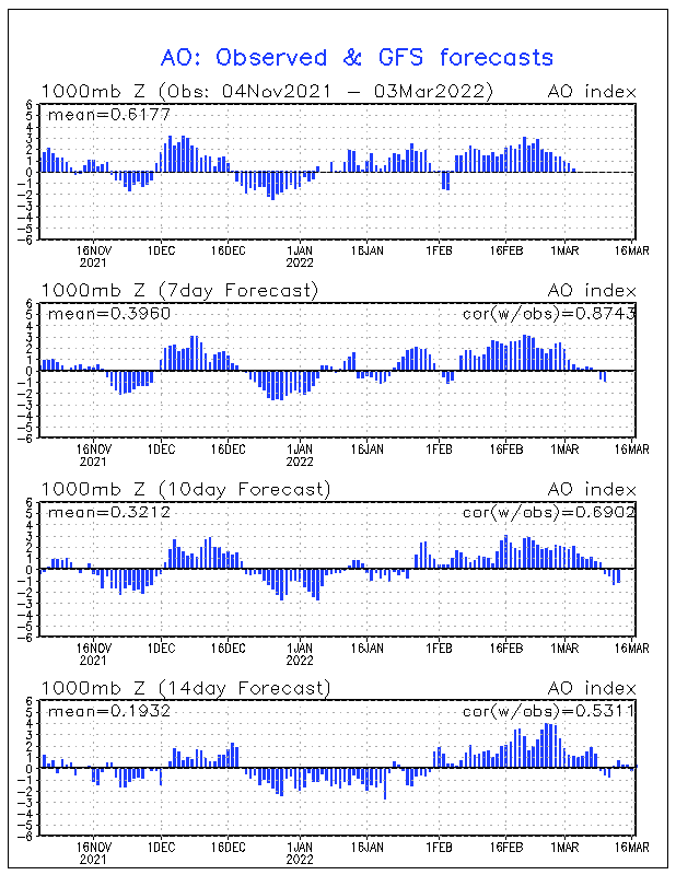
A big question is: Why are models trending westward with more precipitation?  Global Atmospheric Angular Momentum has been in a freefall.  In our case weather systems will tend to have a more longitudinal (N-S) component than E-W,  As AAM goes increasingly negative over an area weather systems can move backwards, called retrograding.  Below you will see a pattern like last December with moderately positive AAM in the tropics and negatives to the north, not typical of La Nina at all.
Source: NOAA Earth Science Research Laboratory
The easy way to understand the diagram is to know that weather systems are progressing west to east in the tropics and subtropics.  Once they gain latitude to about 30N (our Latitude!) the systems turn north and even northwest and amplify.  Areas underneath the green and blue also areas tend to have persistent, repetitive weather patterns. 

Therefore I expect the storm to be close to the coast and have great concern that winter storm snowfalls in excess of 4" will blanket Central NC and VA this weekend.  There will be plenty of cold air available and a real chance for a rapidly intensifying system as it moves up our coast targeting the mid-Atlantic States.

Could something go wrong and cancel the snowstorm?   Yes, it is an unconventional setup and the system could do as many have done in the past .... blow out to sea or focus its snow on eastern NC and VA.  Another possibility is that the storm system could fail to progress far enough north to reach the negative AAM region and thus be weaker and progress quickly out to sea.  Finally, AAM is measured 2 days in the past.  Could the negative region no longer extend this far south?

Stay tuned...

Winter weather overspreads region

Good Morning;

A Winter Weather Advisory remains in effect for Central NC.  Winter Storm Warnings are posted for much of Central VA.  Radar indicates that a broad swath of precipitation has overspread the whole area.  Freezing rain is falling here in NC, snow will be soon hitting the ground in the Richmond area in VA.

RADAR image based in RDU shows moderate rain.
A comfortably warm jet stream blowing around 4500ft has transitioned the snow to sleet and freezing rain.  Ground surface temperatures are frozen to nearly 4" deep! Therefore rain will freeze on contact until the warm jet erodes the surface layer of arctic air enough to get the RDU area above freezing.

Central VA gets a winter wonderland of heavy snow ranging from 3-5" capped with ice. The warm front will not be able to proceed north enough to get them above freezing.

Once the system begins to clear it's effect as a veil between the present and Saturday evening's storm becomes more clear.  Right now the big question is going to be how close to the coast will the weekend system form?  That is somewhat dependent on where the coastal front left by the current system will be located.

Monday, December 13, 2010

The Tale of Two Winter Storms

We in the Raleigh, NC need to keep in mind that no matter how cold it is in December the climate simply does not favor snow.  In fact this morning's trace of snow at the airport set a snowfall record for today. 

As much as MJO Phase 5 and a La Nina increasingly argue for warm it is amazing how the Arctic Oscillation is freezing the warm signals out by reaching pretty extreme negativity for the second December in a row.  This pattern does not bode well for hopes of extended  mild weather in January.  In fact, keep your coats and gloves available.  There is a glimmer of hope for at least a brief break in the form of upper stratospheric cooling over the North Pole.
Warming in Stratosphere over the North Pole send cold air south.
Source: NOAA Climatic Prediction Center
Thursday's Weak Winter Storm
 
There is a weak disturbance that is expected to pass near NC and VA on Thursday morning.  Currently model runs are trending toward a later arrival and further north path.  This would favor a light snowfall in Central VA and a mix to rain in the Raleigh, NC area. 

Small systems like the one on its way for Thursday tend to be moisture starved and small areal coverage.  No one should depend on those storms for dependable results!  Therefore children in school should complete all homework and be prepared for any tests or quizzes.

Potential for real Trouble Saturday-Sunday

Models seem to agree on the formation of an east coast storm system this weekend.  Amazingly enough on Dec 19, 2009 a similar system mostly rained on the Triangle (NC) but postponed my extended family Christmas party!  Could it happen again?

Keep in mind that this is Monday night and snow anytime here in NC is often an exercise in frustration as conditions need a level of perfection to bury us.  Below is a very entertaining GFS scenario that would cause a great deal of consternation in NC and VA.  My opinion so far is that this storm is targeting Central VA.
Low Pressure predicted by the GFS to be dumping pretty heavy precipitation Sunday morning
Source: Plymouth State Weather Center


Stay tuned as both storm systems develop or BUST!!!

Thursday, December 9, 2010

Cold to dominate weather pattern pre-Christmas

It is becoming clear that the global circulation is not ready to cooperate with surface La Nina conditions.  Typically the expectation would be that a cold start to December would give way to a warm subtropical ridge of high pressure and a retreating jet stream. The end result would be a December 20-31 similar to 2007.  The first hint that something was going "wrong" was accurate model predictions of a new high latitude Ridge formation over Western Europe which would then retrograde (move west) into the -NAO zone and effectively reload the dominant cold mechanism this month.

Is there an explanation for why the NAO would reload negative when warm North Atlantic temperatures and cold equatorial Pacific would not typically favor such a move after mid-December? Even though colder than average is expected why is our region near record territory and Great Britain and France in a deep freeze which is smashing records?  The answer is that that the global atmospheric circulation as defined by the Global Wind Oscillation is indicating a progression away from La Nina to a death spiral in neutral territory.
GWO has death spiraled into no man's land.
Source: Earth Science Research Laboratory

 Until a jolt of sorts comes to get the circulation moving we can expect a persistence in the weather pattern.  Therefore cold will reload for a few days around Dec 15 and then renew it's assault on the Eastern US and Western Europe.  By that time the major storm tracks will have shifted further SE and will significantly raise the probability of a rare White Christmas.

Will it ever warm-up?  I am watching northern Australia for the onset of the rainy season. The below satellite image could be used as an argument that the NAO should be positive and our region gearing up for a nice warmer than average weekend.  My suspicion is that even though MJO Phase 5 is moderately  indicated by thunderstorm activity NW of the continent the detail of High Pressure nosing its way in from the east is clouding the whole signal.


Watching for onset of rainy season in N Australia
Source: Univ of Wisc SSEC
MJO 5 has good correlation to Positive NOA and widespread warmth.
Source: NOAA Climatic Prediction Center

If the weather was simple then there would not be so many of us and billions of dollars in computers trying to figure it out.  I am concerned that my promises of long warm segments this season could be frozen out if sufficient snowcover combines with precipitation in the deep south to setup a situation that favors further persistence of the cold.

Monday, December 6, 2010

Can We even Dream of a Warm Christmas?

It is hard to think warm when I saw solid ice on a road in Durham at 1:30 PM today.  Winter's featuring La Nina often start off cold in the Eastern US and Western Europe but this season is definitely a bit extreme.  Great Britain and Ireland are covered in snow!  Recent Satellite photos would make one believe that the two islands used to moderate winters are in an Ice Age.

Great Britain and Ireland are reliving the Little Ice Age
Source: NOAA Earth Observatory
Portions of NC and VA enjoyed an early season snow this past weekend.  Deeper than expected cold allowed a relatively dry system to cover grassy areas with a coating to 2".  I had expected an early season snow by the end of November and was 4 days late.  The question now is whether this La Nina winter will actually behave like most of them and warm up for the holidays and much of January.

In my previous article I mention the potential monkey wrench to a warm Christmas being seen by computer models in the re-forming of a North Atlantic ridge of high pressure and movement into the -NAO region.  Unfortunately that is not off the table.

Out in the Pacific and Siberia models are forecasting weaker versions of the -EPO and -WPO.   The EPO is known as the East Pacific Oscillation.  It's negative phase features trough NE of Hawaii which ultimately leads to an Eastern US trough.  The WPO is the West Pacific Oscillation.  It's negative phase is freezing us right now with arctic air.  A -WPO is a bubble of high pressure in East Siberia which shoves Arctic air over the Pole into our hemisphere.  Here are the forecast values:
Even a weak -EPO is not a warm sign.
WPO is forcast to continue strongly negative.
Source: NOAA Earth Science Research Laboratory


Global Forecast System (GFS) Ensembles provide 12 possible outcomes for Dec 22 (Day 15).  None of them look particularly warm, some are pretty cold.  Could it warm up in the 3 days leading up to Christmas?  This year could feature my most difficult holiday forecast ever because of how small deviations in jet stream and storm tracks can mean big weather differences.

Saturday, December 4, 2010

Snowing in Central NC

Light Snow and some sleet will continue for the next several hours.  Expected accumulations on some grassy hours may make it to an inch.  Here is the 4:25PM Radar image provided by the National Weather Service:
The snow area is mostly NW of Johnston County, NC

Thursday, December 2, 2010

Numbing Cold Next Week, Potentially warm Christmas

Winter is strongly asserting itself as Arctic cold is poised to establish itself beginning with possible snowflakes during Saturday evening.  By Wednesday of next week highs will be in the 40-45 range with lows in the lower 20's.

The reason is a combination of the Negative NAO as evidenced by strong High Pressure near Greenland which blocks cold air displaced by it's cousin the AO (Arctic Oscillation) from progressing eastward therefore forcing it south into our region. 

The Negative North Atlantic Oscillation has been persistent.
It is deepening right now and should relax by mid-Month.
Source: NOAA Climate Prediction Center
The NAO normally goes positive in a typical La Nina season but should it make going negative a habit during this winter then there will be more cold and storms than expected.  This is something that needs to be watched closely. 

Computer models are showing the chilling cold pattern to be stable for more than 10 days.  This GFS Model illustrates the last gasp occurring around Dec 12.  By then the -NAO is gone (Could the Europe High pressure retrograde west for Christmas?).  Ridging moves in east of Hawaii correlating to east coast ridging (warmer) 3-5 days later.  The mechanism to send Arctic air over the Pole from Siberia is also forecast to be gone.   
The beginning of the end of the cold pattern.
Source: Plymouth State Weather Center
This is a case where the model fits the typical winter weather pattern.  If the timing is right then much warmer temperatures move in around Dec 15th.  Christmas and New Year have the potential to be very warm .... IF the European High Pressure does not find itself near Greenland (Negative NAO) by that time.

Typical La Nina Winter in our Area

The arrival of cold temperatures coincides well with a typical Central NC and VA La Nina winter.  Shorter wavelengths in the Jet Stream pattern allow features which normally would correlate well to warm to temporarily favor cold conditions.

Please forgive the terrible art work.  As winter deepens and waves of circulation broaden average temperatures rise above average resulting in long stretches of mild and dry weather,  Shortly after mid January a natural surge of Atmospheric Angular Momentum creates a condition which pushes the cold winter weather region into the east.  Once that bout of real winter is over then a thaw dominates until Valentines Day.
The best chance for a Winter Storm is shortly after Jan 15