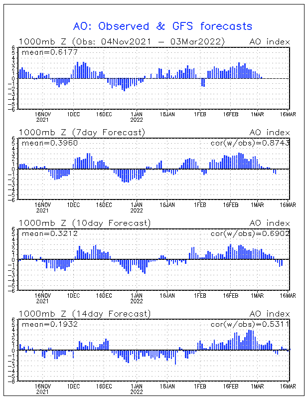
The reason is a combination of the Negative NAO as evidenced by strong High Pressure near Greenland which blocks cold air displaced by it's cousin the AO (Arctic Oscillation) from progressing eastward therefore forcing it south into our region.
 |
| The Negative North Atlantic Oscillation has been persistent. It is deepening right now and should relax by mid-Month. Source: NOAA Climate Prediction Center |
Computer models are showing the chilling cold pattern to be stable for more than 10 days. This GFS Model illustrates the last gasp occurring around Dec 12. By then the -NAO is gone (Could the Europe High pressure retrograde west for Christmas?). Ridging moves in east of Hawaii correlating to east coast ridging (warmer) 3-5 days later. The mechanism to send Arctic air over the Pole from Siberia is also forecast to be gone.
 |
| The beginning of the end of the cold pattern. Source: Plymouth State Weather Center |
No comments:
Post a Comment